August 15-21, 2026
Temperature
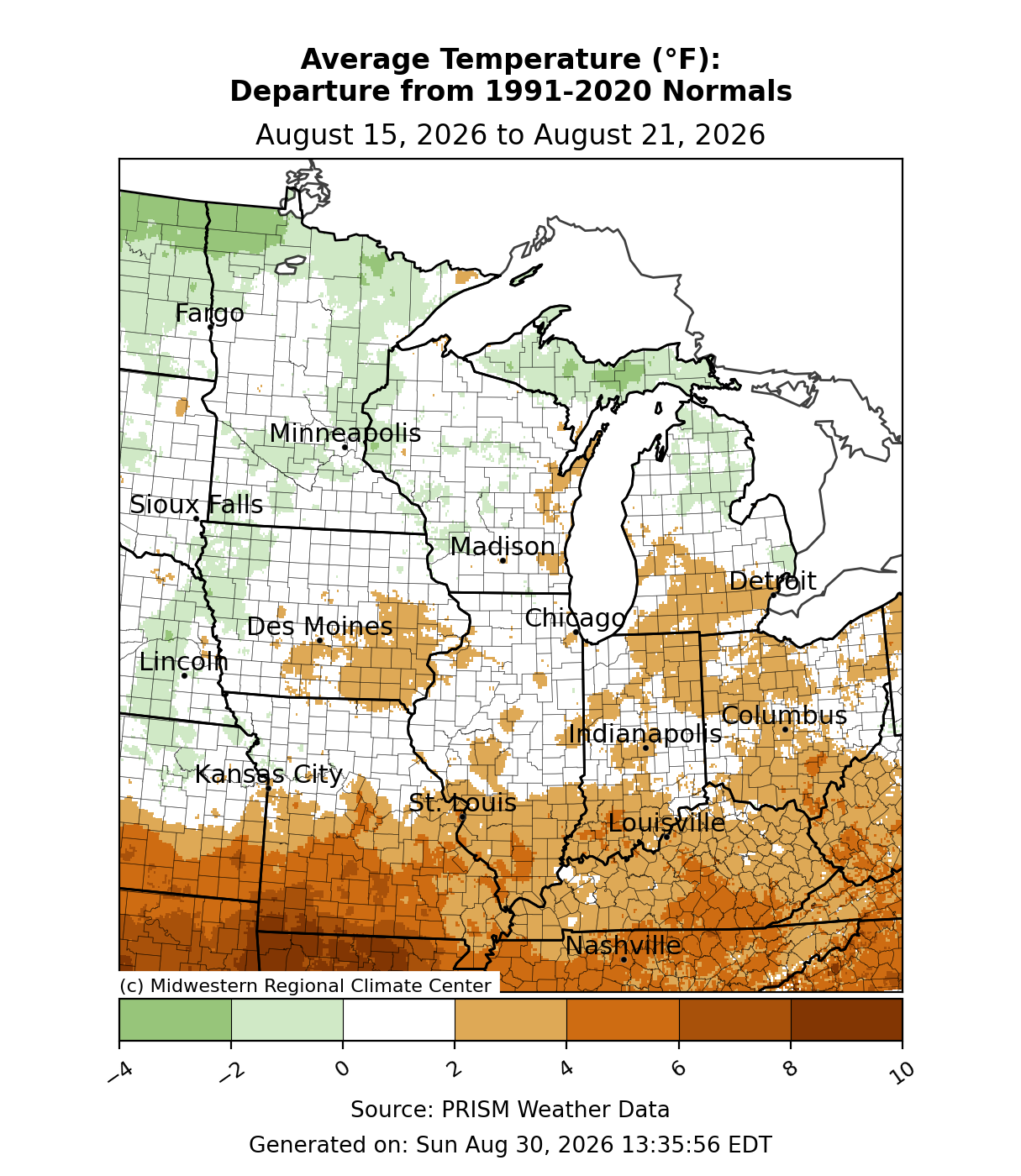
Average temperatures were generally near normal across the region (Figure 1). The northernmost parts of the region, Michigan’s Upper Peninsula (UP) and northern Minnesota, were slightly below normal for the week. The southernmost parts of the region, southern Missouri and Kentucky, were roughly 3-6°F below normal. All other locations observed average temperatures near normal.
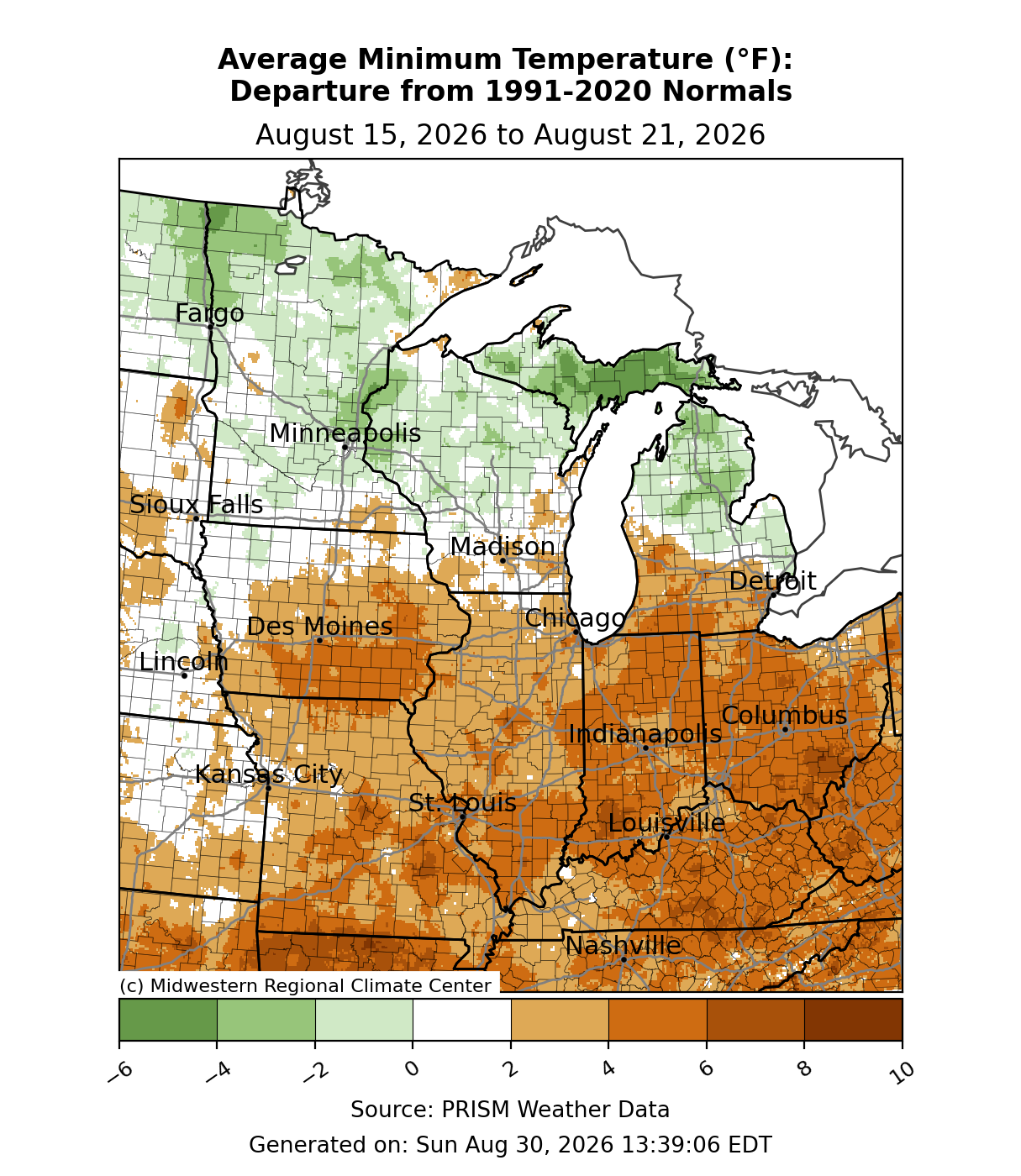
Minimum temperatures were above normal from roughly I-80 southward (Figure 2). The lower half of the region observed minimum temperatures anywhere from 2-6°F above normal. The Upper Midwest was near to slightly below normal, with higher anomalies across the UP.
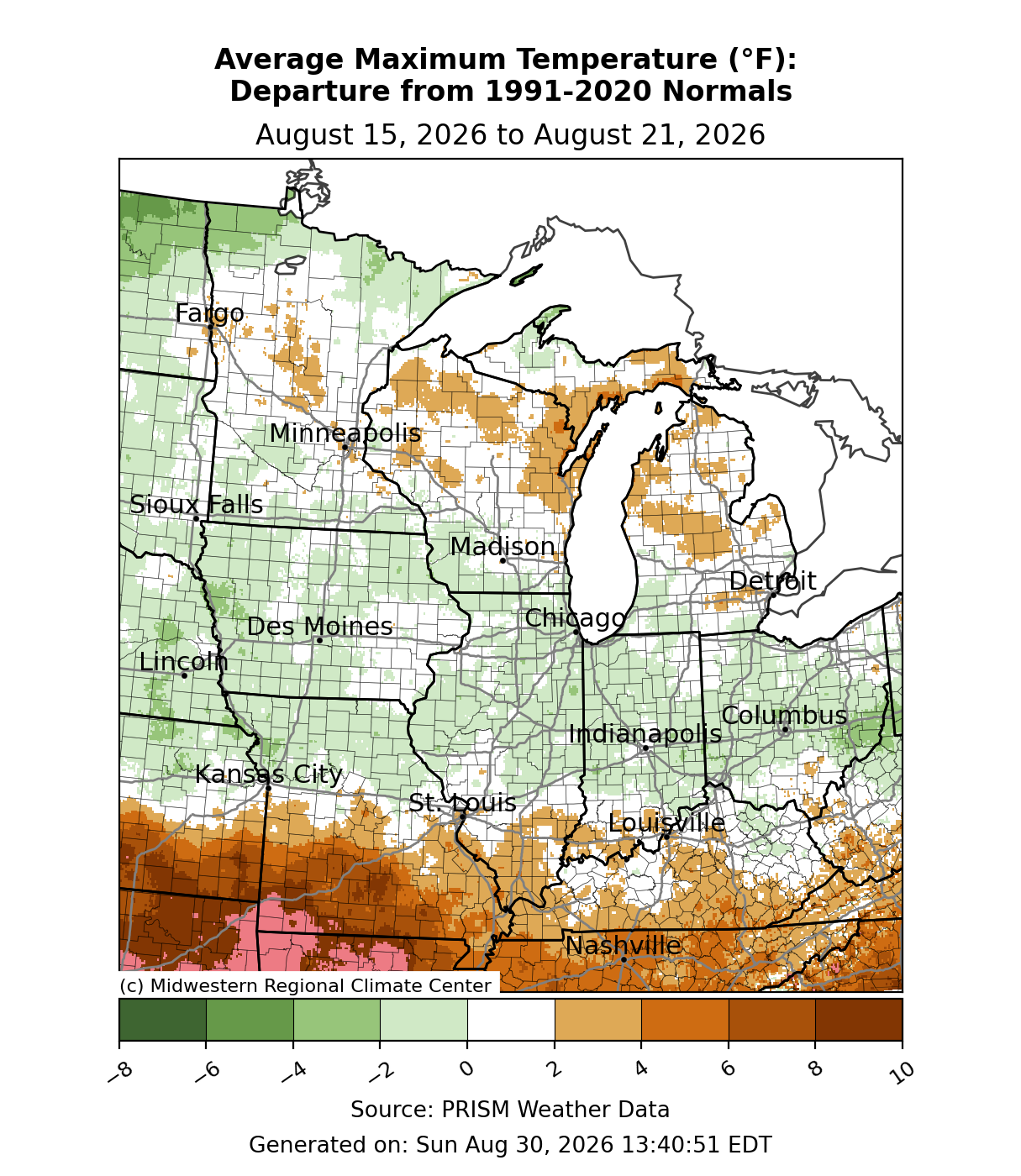
Maximum temperatures were mostly near normal, with pockets of slightly more anomalous departures (Figure 3). In far southwestern Missouri, maximum temperatures were over 10°F above normal. In Billings, Missouri, a station with records dating back to 1962 observed 5 days of temperatures at or above 100°F, which was the longest consecutive stretch of 100°F+ temperatures since 2007. It also tied the record for the 3rd longest consecutive stretch of 100°F+ in Billings. The area between I-70 and I-80 was near to slightly below normal by up to 2°F. Across the Upper Midwest, maximum temperatures were mostly near normal, with pockets of above-normal temperatures across Michigan and Wisconsin and pockets of below-normal temperatures across northern Minnesota.
Precipitation/Drought
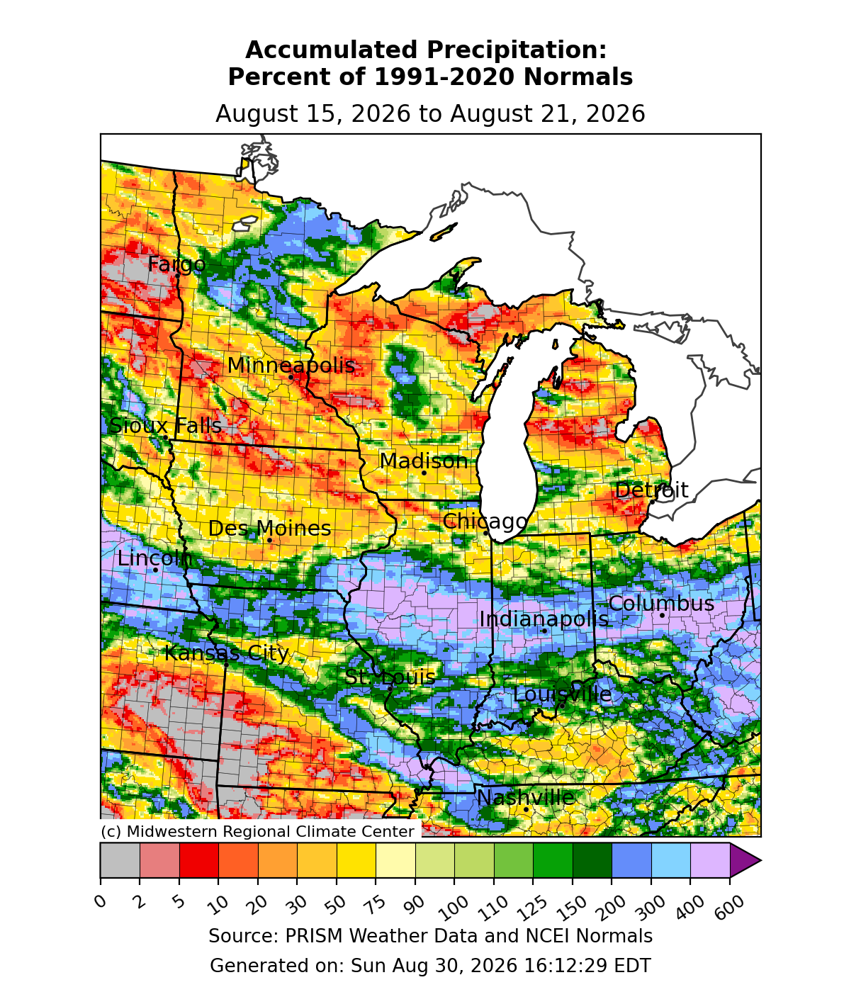
Precipitation was above normal through the region’s midsection (Figure 4). Areas like central Illinois, central Indiana, and central Ohio—which already received a month’s worth of precipitation in the prior two weeks—observed another week of precipitation over 300-400 percent of normal. As a result, waterways across the region rose to record or near-record levels. The White River at 82nd Street in Indianapolis rose to major flood stage on August 15, cresting at 21.18 feet, the second-highest crest on record. The White River crested at 24.93 feet in Anderson, Indiana on August 15, which broke the prior record of 21.60 feet set during the Great Flood of 1913. Precipitation was below normal across much of the Upper Midwest and southwestern Missouri.
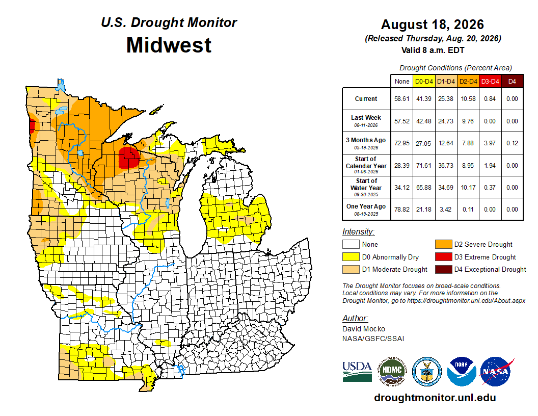
From August 11 to August 18, drought expansions and removals were negligible (Figure 5). Drought conditions declined by less than 1 percent across the D1 (moderate drought), D2 (severe drought), and D3 (extreme drought) categories. D0 (abnormally dry) saw improvement by just over 1 percent, most of which occurred across the rain-soaked corn belt. Slight expansions were made across northern Wisconsin, where D3 appeared for the first time in the state since October 2023.
Severe Weather
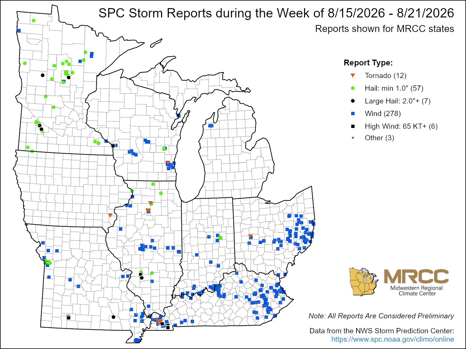
There were over 300 reports of severe weather this week. At least 278 were reports of straight-line winds, while 57 were hail reports and 12 were tornado reports (Figure 6). Widespread reports of tree damage occurred across eastern Ohio as a result of storms on August 16. On August 17, isolated storms in northern Minnesota produced hail larger than 2 inches in Otter Tail County. Straight line winds that reached 80-100 mph were reported across western Kentucky on August 19-20, which resulted in multiple outbuildings and homes destroyed. Two EF1 tornadoes were reported across western Kentucky early on August 20, both of which had estimated peak winds of at least 10 mph.