March 22-31, 2026
Temperature
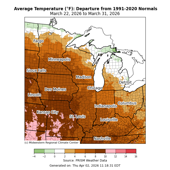
Temperatures averaged above normal for most of the region (Figure 1). Average temperatures were as much as 10°F+ above normal in parts of Missouri. Most of the region was 4-8°F above normal, save far northern parts of the region, where temperatures averaged near normal.
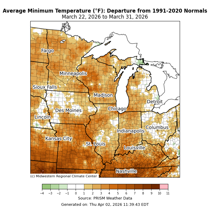
Minimum temperatures averaged above normal for much of the region (Figure 2). While some areas were near to slightly above normal, other areas, particularly across southern Missouri and Kentucky, were closer to 6°F above normal.
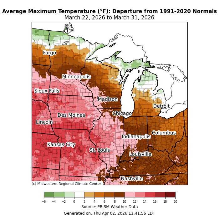
Maximum temperatures were up to 15°F above normal across from I-55 westward (Figure 3). Even across the Ohio River Valley, maximum temperatures were generally 5-10°F above normal. Only across the far north were maximum temperatures near to slightly below normal.
Precipitation/Drought
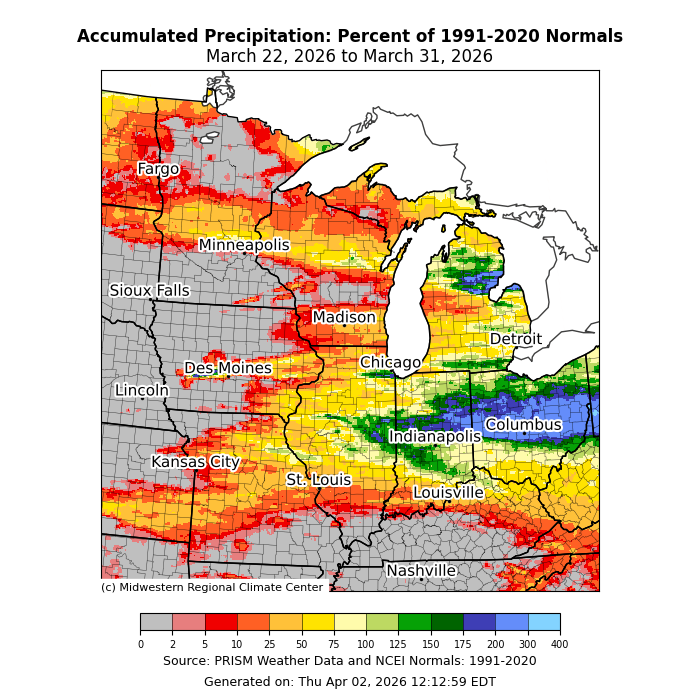
Precipitation was lackluster as most areas west of the Mississippi River ended the week with little to no precipitation (Figure 4). Precipitation was only near- to above normal across central Indiana and central Ohio. This was due to a front that slowed over these areas, bringing multiple rounds of heavy precipitation. One station in Bellefontaine, Ohio, with records dating back to 1894, observed 2.20 inches of precipitation on March 27, making it the third wettest day in March on record and the wettest since 1913 at that station.
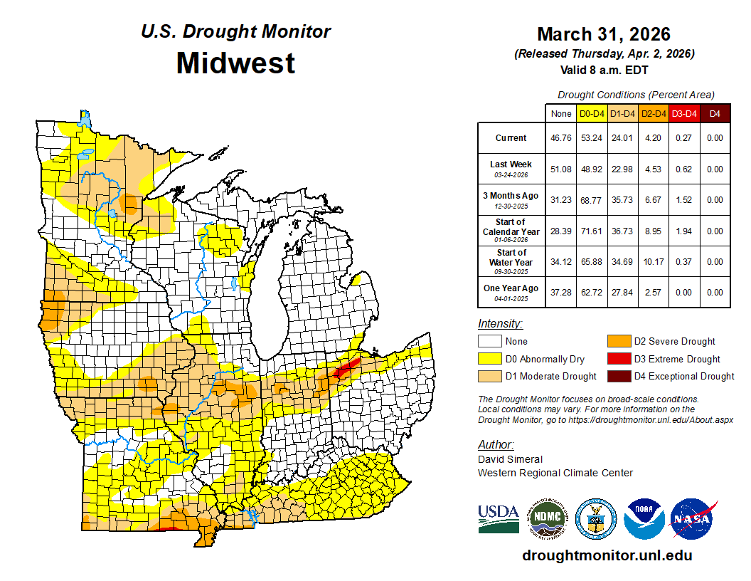
There was minimal progression in drought conditions across the region this week. D0 (abnormally dry) and D1 (moderate drought) both expanded by under 5 percent (Figure 5). D2 (severe drought) improved for several areas across Illinois, Indiana, Kentucky, and Missouri. D3 (extreme drought) was erased across eastern Illinois and improved across northwestern Ohio.
Severe Weather
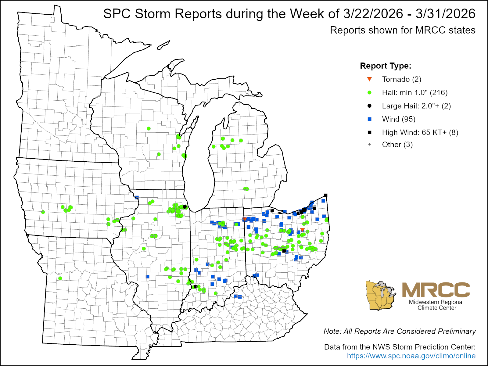
There were over 300 storm reports this week, with over 200 hail reports and 95 wind reports (Figure 6). The first outbreak occurred on March 26 across Illinois, Indiana, and Ohio. The March 26 outbreak brought several brief EF0 and EF1 tornadoes across Indiana and Ohio. However, this outbreak was notable for its hail, with some reports of hail reaching 2-3 inches in diameter, nearly the size of a lemon.
Most of the wind reports came on the final day of the week, March 31, when severe weather ripped through northern Indiana and northern Ohio. A mesonet station near Cleveland, Ohio, reported a wind gust of 75 mph. Meanwhile, a brief EF1 tornado with estimated peak winds of 95 mph touched down in Defiance County, Ohio, while an EF0 touched down in Wayne County, Ohio.